2024 Map of New Hope
USGS Topo · Published 2024About this map
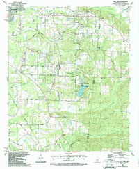
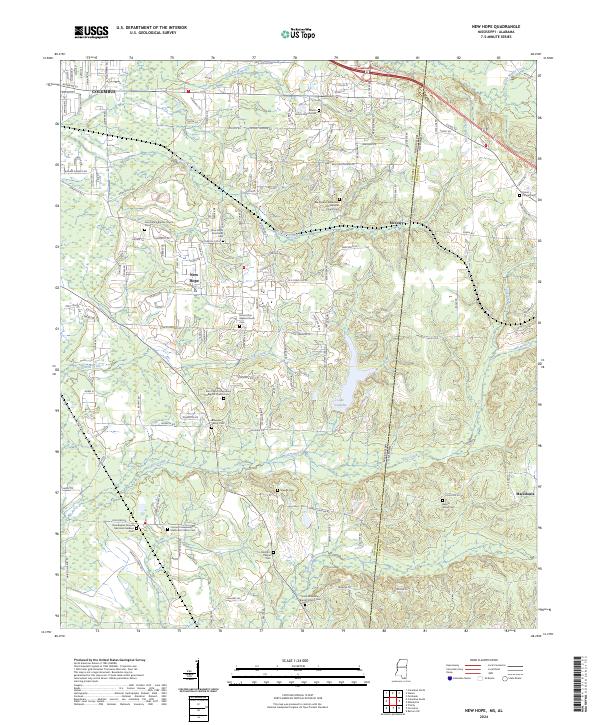
The Mississippi Alabama state line bisects this landscape, separating the residential growth of eastern Lowndes County from the rural reaches of Pickens County. Lake Lowndes serves as a central geographic anchor, fed by the waters of McCrary Creek and Greens Creek. The settlement patterns here are deeply tied to congregational history, evidenced by the numerous church-centered communities such as McCrary and New Hope. Genealogists will find a dense concentration of burial grounds, ranging from established congregational sites like the Union Missionary Baptist Church Cem to smaller, family-oriented plots such as the Brownlee Family Cem. In the southern portion of the quadrangle, the community of Macedonia sits near the headwaters of Bell Branch, while the suburban expansion of Columbus begins to reach into the northwestern corner along Alabama St and Airline Rd.
Find a feature on this map
142 named features on this map. Tap any name to fly to it.
Don’t see what you’re looking for? This feature index may not catch every label — zoom into the map to look around manually.
Map Details
Editions of this 2024 New Hope Map
This is the sole edition of this map. No revisions or reprints were ever made.