2024 Map of New Llano
USGS Topo · Published 2024About this map
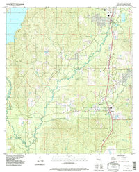
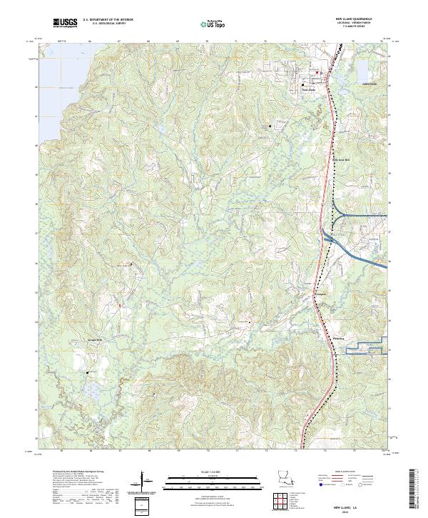
New Llano and the southern outskirts of Leesville anchor the northeastern portion of this Vernon Parish landscape. The area is defined by the heavy presence of Fort Polk, which occupies significant terrain in the eastern half of the quadrangle. Outside the military installation, the landscape transitions into a network of timbered ridges and creek bottoms, including Bayou Anacoco and Bayou Castor. For local historians and genealogists, this 2024 map is particularly rich in family-named landmarks and rural burial sites. A concentration of small family and community cemeteries, such as Gill Cem, Wilson Family Cem, Cooper Cem, and Cryer Cem, are scattered across the terrain. Small settlements and named locales like Coopers, Pickering, and the notably named Billy Goat Hill trace the historical development and rural infrastructure of this part of Louisiana, connected by a web of parish and logging roads like Ford's Dairy Rd and Savage Forks Rd.
Find a feature on this map
110 named features on this map. Tap any name to fly to it.
Don’t see what you’re looking for? This feature index may not catch every label — zoom into the map to look around manually.
Map Details
Editions of this 2024 New Llano Map
This is the sole edition of this map. No revisions or reprints were ever made.