
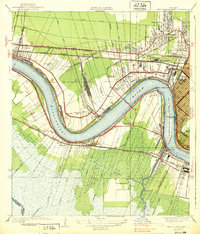
1932 Map of New Orleans SW
USGS Topo · Published 1932About this map
Lake Salvador and Lake Cataouatche dominate this 1932 deltaic landscape, where the shifting boundaries of St Charles Parish and Jefferson Parish meet amidst a dense network of marshes and waterways. The map illustrates the early 20th-century transition of the Louisiana wetlands, highlighting the newly established State Intracoastal Waterway Barataria Bayou alongside traditional settlements like Waggaman and Woods Place.
Find a feature on this map
19 named features on this map. Tap any name to fly to it.
Don’t see what you’re looking for? This feature index may not catch every label — zoom into the map to look around manually.
Map Details
Editions of this 1932 New Orleans SW Map
This is the sole edition of this map. No revisions or reprints were ever made.
Other maps of this area

1891 · Hahnville
USGS Topo · 1:62,500

1891 · New Orleans
USGS Topo · 1:62,500

1892 · Barataria
USGS Topo · 1:62,500

1892 · Cut-Off
USGS Topo · 1:62,500

1932 · New Orleans NE
USGS Topo · 1:31,680

1932 · New Orleans NW
USGS Topo · 1:31,680

1932 · New Orleans SE
USGS Topo · 1:31,680

1932 · Hahnville NE
USGS Topo · 1:31,680

1935 · Luling
USGS Topo · 1:31,680
1938 · New Orleans West
USGS Topo · 1:31,680