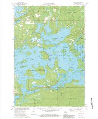
1972 Map of New Post
USGS Topo · Published 1983About this map
Lake Chippewa dominates this landscape, its intricate shoreline and numerous islands defining the character of Sawyer County in the early 1970s. The settlement of New Post sits along the southern edge of the water near James Slough, within the Lac Courte Oreilles Indian Reservation Boundary. This survey reveals a transition between managed timberlands and recreational water use, with the Chequamegon National Forest bordering the lake to the northeast. Notable landmarks like Hermans Landing, several boat ramps, and the Blueberry Campground indicate the area's importance for local recreation. The map also records small-scale resource extraction at the Gravel Pit and Sandpit, alongside civic structures such as the Townhall. Distinctive water passages like Hay Creek Narrows and Chief Narrows navigate between named landforms including Darrow Island and Big Timber Island.
Find a feature on this map
56 named features on this map. Tap any name to fly to it.
Don’t see what you’re looking for? This feature index may not catch every label — zoom into the map to look around manually.
Map Details
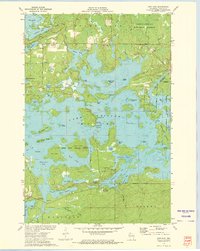
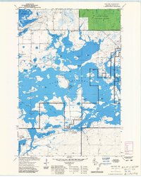
Editions of this 1972 New Post Map
3 editions found
Other maps of this area

1943 · Namekagon Lake
USGS Topo · 1:48,000

1944 · Couderay
USGS Topo · 1:48,000

1944 · Radisson
USGS Topo · 1:48,000

1944 · Hayward
USGS Topo · 1:48,000

1945 · Namekagon Lake
USGS Topo · 1:48,000

1948 · Couderay
USGS Topo · 1:48,000

1949 · Radisson
USGS Topo · 1:48,000

1953 · Ashland
USGS Topo · 1:250,000

1953 · Rice Lake
USGS Topo · 1:250,000

1958 · Ashland
USGS Topo · 1:250,000