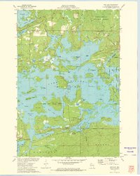
1972 Map of New Post
USGS Topo · Published 1975About this map
Chippewa Lake dominates this northern Wisconsin landscape, its irregular shoreline defined by countless points, bays, and islands such as Darrow Island and Big Banana Island. The 1972 survey reveals a transition between managed timberlands and recreational lakeside development, with the Chequamegon National Forest bordering the eastern edge and the Lac Courte Oreilles Indian Reservation Boundary cutting through the center. The settlement of New Post serves as a local hub near the southern shore of Carpenter Lake. Detailed depth curves, compiled by the Wisconsin Department of Natural Resources, highlight the complex underwater topography of these glacial basins. This era shows an established network of campsites and boat access points, including Hermans Landing and Blueberry Campground, reflecting the region's importance for fishing and tourism. Smaller bodies of water like Moonshine Lake and Two Boys Lake are scattered throughout the dense woods, connected by marshes and drainage points like James Slough.
Find a feature on this map
67 named features on this map. Tap any name to fly to it.
Don’t see what you’re looking for? This feature index may not catch every label — zoom into the map to look around manually.
Map Details
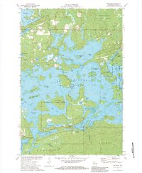
Editions of this 1972 New Post Map
3 editions found
Other maps of this area

1943 · Namekagon Lake
USGS Topo · 1:48,000

1944 · Couderay
USGS Topo · 1:48,000

1944 · Radisson
USGS Topo · 1:48,000

1944 · Hayward
USGS Topo · 1:48,000

1945 · Namekagon Lake
USGS Topo · 1:48,000

1948 · Couderay
USGS Topo · 1:48,000

1949 · Radisson
USGS Topo · 1:48,000

1953 · Ashland
USGS Topo · 1:250,000

1953 · Rice Lake
USGS Topo · 1:250,000

1958 · Ashland
USGS Topo · 1:250,000