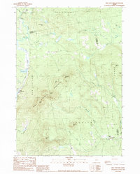
1989 Map of New Vineyard
USGS Topo · Published 1989About this map
New Vineyard Mountains dominate the center of this western Maine landscape, anchoring a high-relief terrain of granite peaks and narrow valleys. The settlement of New Vineyard sits tucked between the slopes and Mill Pond, while the smaller hamlet of West Mills is positioned to the southeast along Falls Brook. Water serves as the primary sculptor of the local geography, with Lemon Stream and Barker Brook carving deep routes through the hills.
Find a feature on this map
37 named features on this map. Tap any name to fly to it.
Don’t see what you’re looking for? This feature index may not catch every label — zoom into the map to look around manually.
Map Details
Editions of this 1989 New Vineyard Map
This is the sole edition of this map. No revisions or reprints were ever made.
Other maps of this area

1894 · Norridgewock
USGS Topo · 1:62,500

1898 · Norridgewock
USGS Topo · 1:62,500

1904 · Anson
USGS Topo · 1:62,500

1924 · Farmington
USGS Topo · 1:62,500

1930 · Kingfield
USGS Topo · 1:48,000

1932 · Kingfield
USGS Topo · 1:62,500

1943 · Norridgewock
USGS Topo · 1:62,500

1948 · Bangor
USGS Topo · 1:250,000

1950 · Lewiston
USGS Topo · 1:250,000

1955 · Anson
USGS Topo · 1:62,500