
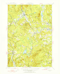
1930 Map of Kingfield
USGS Topo · Published 1930About this map
Kingfield serves as the focal point for this 1930 survey, situated at the confluence of the Carrabassett River and Sandy Stream. The landscape is defined by its transition from the valley floors to the high elevations of Vose Mtn and Pinnacle Hill, reflecting a period when the mountain topography dictated the location of upland farms and rural schoolhouses. The settlement pattern shows a dense network of local education, with Freeman Center Sch and Peabody Sch serving the dispersed farming communities of Freeman and New Vineyard.
Find a feature on this map
77 named features on this map. Tap any name to fly to it.
Don’t see what you’re looking for? This feature index may not catch every label — zoom into the map to look around manually.
Map Details
Editions of this 1930 Kingfield Map
4 editions found
Other maps of this area

1894 · Norridgewock
USGS Topo · 1:62,500

1898 · Norridgewock
USGS Topo · 1:62,500

1903 · Bingham
USGS Topo · 1:62,500

1904 · Anson
USGS Topo · 1:62,500

1905 · Bingham
USGS Topo · 1:62,500

1924 · Farmington
USGS Topo · 1:62,500

1926 · Dixfield
USGS Topo · 1:62,500

1928 · Dead River
USGS Topo · 1:62,500

1928 · Stratton
USGS Topo · 1:48,000

1929 · Phillips
USGS Topo · 1:48,000