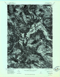
1977 Map of Kingfield
USGS Topo · Published 1983About this map
Kingfield serves as the focal point of this 1970s orthophotoquad, situated at the confluence of the Carrabassett River and the West Branch. The aerial imagery reveals the precise layout of the town's streets and building footprints during a period of transition in the Maine woods. West of the primary settlement, the small clearing at Soule Mill along Soule Mill Stream points to the area's timber and milling heritage, showing how industry was historically sited near essential water power.
Find a feature on this map
7 named features on this map. Tap any name to fly to it.
Don’t see what you’re looking for? This feature index may not catch every label — zoom into the map to look around manually.
Map Details
Editions of this 1977 Kingfield Map
This is the sole edition of this map. No revisions or reprints were ever made.
Other maps of this area

1928 · Dead River
USGS Topo · 1:62,500

1928 · Stratton
USGS Topo · 1:48,000

1929 · Phillips
USGS Topo · 1:48,000

1930 · Kingfield
USGS Topo · 1:48,000

1931 · Dead River
USGS Topo · 1:48,000

1932 · Phillips
USGS Topo · 1:62,500

1932 · Stratton
USGS Topo · 1:62,500

1932 · Kingfield
USGS Topo · 1:62,500

1944 · Dead River
USGS Topo · 1:62,500

1949 · Jackman
USGS Topo · 1:250,000