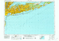
1960 Map of New York
USGS Topo · Published 1979About this map
Long Island and the expanding outer boroughs of New York are depicted here during a period of massive suburban growth and infrastructure development. The landscape is defined by the dense residential corridors of Brooklyn and Queens, connected to the interior of the island by the arterial Long Island Expwy and the Southern State Pkwy. Large institutional footprints such as Kennedy Intl Airport and Laguardia Airport reflect the era's focus on modern transit, while the sprawling Long Island RR network remains the backbone for older towns from Glen Cove to Montauk Point. This survey provides a comprehensive view of the mid-century transition from rural estates to high-density suburbs, punctuated by major landmarks like the Statue of Liberty and the UN Headquarters, alongside significant local historical sites including Green-Wood Cem and Pinelawn Cem.
Find a feature on this map
175 named features on this map. Tap any name to fly to it.
Don’t see what you’re looking for? This feature index may not catch every label — zoom into the map to look around manually.
Map Details
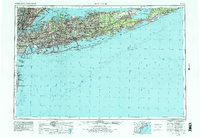
Editions of this 1960 New York Map
2 editions found
Other maps of this area

1888 · Barnegat
USGS Topo · 1:62,500

1888 · Asbury Park
USGS Topo · 1:62,500

1888 · Paterson
USGS Topo · 1:62,500

1888 · Sandy Hook
USGS Topo · 1:62,500

1889 · Brooklyn
USGS Topo · 1:62,500

1891 · Ramapo
USGS Topo · 1:62,500

1891 · Brooklyn
USGS Topo · 1:62,500

1891 · Harlem
USGS Topo · 1:62,500

1891 · Bridgeport
USGS Topo · 1:62,500

1892 · Stamford
USGS Topo · 1:62,500