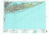
1960 Map of New York
USGS Topo · Published 1979About this map
Long Island stretches from the dense urban centers of New York, Brooklyn, and Queens to the rugged tip of Montauk Point. This 1979 revision, based on earlier surveys from the 1930s to the late 1950s, documents the peak of the post-war suburban era. The expansion of the Long Island RR and arterial highways like the Sunrise Highway facilitated massive growth in places like Brentwood and Central Islip.
Find a feature on this map
116 named features on this map. Tap any name to fly to it.
Don’t see what you’re looking for? This feature index may not catch every label — zoom into the map to look around manually.
Map Details
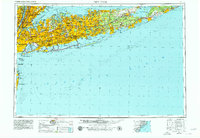
Editions of this 1960 New York Map
2 editions found
Other maps of this area

1888 · Barnegat
USGS Topo · 1:62,500

1888 · Asbury Park
USGS Topo · 1:62,500

1888 · Paterson
USGS Topo · 1:62,500

1888 · Sandy Hook
USGS Topo · 1:62,500

1889 · Brooklyn
USGS Topo · 1:62,500

1891 · Ramapo
USGS Topo · 1:62,500

1891 · Brooklyn
USGS Topo · 1:62,500

1891 · Harlem
USGS Topo · 1:62,500

1891 · Bridgeport
USGS Topo · 1:62,500

1892 · Stamford
USGS Topo · 1:62,500