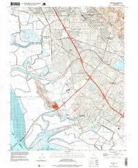
1997 Map of Newark
USGS Topo · Published 1999About this map
Salt evaporators and tidal sloughs dominate the edge of San Francisco Bay in this late-twentieth-century study of the East Bay. The landscape reveals the complex administrative layering of the region, where Union City (Alvarado) and Union City (Decoto) represent formerly distinct communities now integrated into a larger municipal fabric. Further south, the Fremont (Centerville District) and the city of Newark show dense suburban growth pushing toward the historic Patterson Ranch and the base of the Coyote Hills. The infrastructure of the era is clearly visible, from the Hetch Hetchy Aqueduct cutting across the salt ponds to the industrial corridors along the Southern Pacific tracks and Transit lines. The survival of names like Jarvis Landing and Mowry Landing preserves the memory of nineteenth-century maritime commerce along Newark Slough and Plummer Creek.
Find a feature on this map
77 named features on this map. Tap any name to fly to it.
Don’t see what you’re looking for? This feature index may not catch every label — zoom into the map to look around manually.
Map Details
Editions of this 1997 Newark Map
This is the sole edition of this map. No revisions or reprints were ever made.
Other maps of this area

1889 · San Jose
USGS Topo · 1:62,500

1897 · San Jose
USGS Topo · 1:62,500

1897 · Palo Alto
USGS Topo · 1:62,500

1899 · San Jose
USGS Topo · 1:62,500

1899 · Palo Alto
USGS Topo · 1:62,500

1899 · Haywards
USGS Topo · 1:62,500

1902 · Santa Cruz
USGS Topo · 1:125,000

1906 · Pleasanton
USGS Topo · 1:62,500

1915 · Haywards
USGS Topo · 1:62,500

1941 · Pleasanton
USGS Topo · 1:62,500