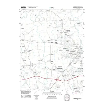
2011 Map of Newark West
USGS Topo · Published 2011About this map
Big Elk Creek and the Christina River systems converge in this cross-border region where Delaware, Maryland, and Pennsylvania meet. The landscape is marked by a transition from the agricultural expanses of Kemblesville and Strickersville in the north to the dense academic and residential corridors of Newark in the south. The University of Delaware campus dominates the southeastern portion, with specific facilities such as Townsend Hall and Clayton Hall clearly noted.
Find a feature on this map
205 named features on this map. Tap any name to fly to it.
Don’t see what you’re looking for? This feature index may not catch every label — zoom into the map to look around manually.
Map Details
Editions of this 2011 Newark West Map
This is the sole edition of this map. No revisions or reprints were ever made.
Other maps of this area

1898 · Elkton
USGS Topo · 1:62,500

1900 · Elkton
USGS Topo · 1:62,500

1901 · West Chester
USGS Topo · 1:62,500

1904 · West Chester
USGS Topo · 1:62,500

1904 · Coatesville
USGS Topo · 1:62,500

1904 · Wilmington
USGS Topo · 1:62,500

1906 · Coatesville
USGS Topo · 1:62,500

1906 · Wilmington
USGS Topo · 1:62,500

1917 · Elkton
USGS Topo · 1:62,500

1918 · Coatesville
USGS Topo · 1:62,500