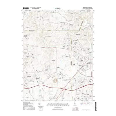
2014 Map of Newark West
USGS Topo · Published 2014About this map
The Univ of Delaware campus and its surrounding neighborhoods anchor the eastern portion of this landscape, where the tri-state boundaries of Delaware, Maryland, and Pennsylvania converge. This modern survey illustrates the dense residential growth and institutional expansion in Newark alongside the preservation of several historic burial grounds, including the centrally located Saint Johns Cem and the small Boot Hill Cem further west.
Find a feature on this map
226 named features on this map. Tap any name to fly to it.
Don’t see what you’re looking for? This feature index may not catch every label — zoom into the map to look around manually.
Map Details
Editions of this 2014 Newark West Map
This is the sole edition of this map. No revisions or reprints were ever made.
Other maps of this area

1898 · Elkton
USGS Topo · 1:62,500

1900 · Elkton
USGS Topo · 1:62,500

1901 · West Chester
USGS Topo · 1:62,500

1904 · West Chester
USGS Topo · 1:62,500

1904 · Coatesville
USGS Topo · 1:62,500

1904 · Wilmington
USGS Topo · 1:62,500

1906 · Coatesville
USGS Topo · 1:62,500

1906 · Wilmington
USGS Topo · 1:62,500

1917 · Elkton
USGS Topo · 1:62,500

1918 · Coatesville
USGS Topo · 1:62,500