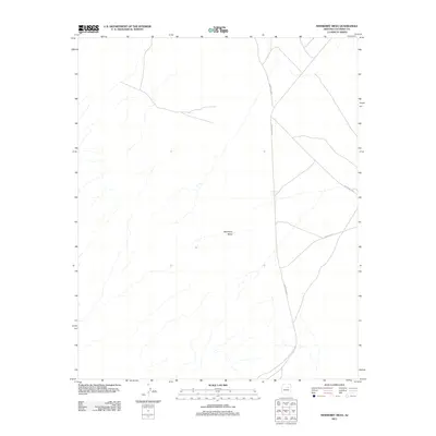
2011 Map of Newberry Mesa
USGS Topo · Published 2011About this map
Newberry Mesa defines this high desert landscape in Coconino County, characterized by its isolation and the network of routes connecting tribal lands. At the beginning of the 21st century, the terrain is primarily marked by drainage patterns and the established paths of Leupp-Oraibi Rd and Indian Rte 6720, which intersect the eastern portion of the quadrangle. These roads serve as vital arteries in a region where topography and distance dictate the flow of movement. The presence of Indian Rte 24 and Indian Rte 6912 in the southeastern corner further illustrates the modern infrastructure developed to traverse this expansive mesa country.
Find a feature on this map
5 named features on this map. Tap any name to fly to it.
Don’t see what you’re looking for? This feature index may not catch every label — zoom into the map to look around manually.
Map Details
Editions of this 2011 Newberry Mesa Map
This is the sole edition of this map. No revisions or reprints were ever made.
Other maps of this area

1883 · Tusayan
USGS Topo · 1:250,000

1886 · Tusayan
USGS Topo · 1:250,000

1886 · San Francisco Mtns
USGS Topo · 1:250,000

1891 · San Francisco Mtns
USGS Topo · 1:250,000

1894 · San Francisco Mtns
USGS Topo · 1:250,000

1899 · San Francisco Mtns
USGS Topo · 1:250,000

1947 · Flagstaff
USGS Topo · 1:250,000

1954 · Flagstaff
USGS Topo · 1:250,000

1955 · Winslow 2 SW
USGS Topo · 1:24,000

1955 · Grand Falls NE
USGS Topo · 1:24,000