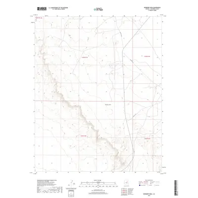
2018 Map of Newberry Mesa
USGS Topo · Published 2018About this map
Newberry Mesa defines the central topography of this section of Coconino County, where the high desert plateau gives way to a complex network of branching drainages and escarpments. The landscape is primarily organized by the Public Land Survey System, with the intersections of t24n r13e, t24n r14e, and t23n r13e marking the transition from the mesa's flat summit to the eroded breaks below. Modern transportation in this arid region is facilitated by a network of tribal routes, including Indian Rte 24 and Indian Rte 6812, which traverse the open country. These roads provide the primary access through a terrain characterized by subtle elevation changes and the distinct landforms of the high Arizona desert, offering a clear record of the area's geography in the early twenty-first century.
Find a feature on this map
9 named features on this map. Tap any name to fly to it.
Don’t see what you’re looking for? This feature index may not catch every label — zoom into the map to look around manually.
Map Details
Editions of this 2018 Newberry Mesa Map
This is the sole edition of this map. No revisions or reprints were ever made.
Other maps of this area

1883 · Tusayan
USGS Topo · 1:250,000

1886 · Tusayan
USGS Topo · 1:250,000

1886 · San Francisco Mtns
USGS Topo · 1:250,000

1891 · San Francisco Mtns
USGS Topo · 1:250,000

1894 · San Francisco Mtns
USGS Topo · 1:250,000

1899 · San Francisco Mtns
USGS Topo · 1:250,000

1947 · Flagstaff
USGS Topo · 1:250,000

1954 · Flagstaff
USGS Topo · 1:250,000

1955 · Winslow 2 SW
USGS Topo · 1:24,000

1955 · Grand Falls NE
USGS Topo · 1:24,000