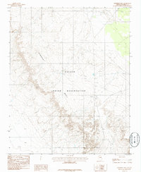
1986 Map of Newberry Mesa
USGS Topo · Published 1986About this map
Newberry Mesa dominates this landscape, its steep escarpments and intricate drainage patterns defining the geography within the Navajo Indian Reservation in Coconino County. Compiled from aerial photography taken in 1979 and field-checked in 1982, this document illustrates the high desert terrain of Northern Arizona during the mid-1980s. The map emphasizes the landform's elevation and topographical detail, showing a network of trails and unimproved roads that navigate the mesa's complex surface. As a provisional edition, it captures a specific period of federal mapping where primary focus was placed on physical terrain and boundary delineations within the reservation, providing a precise record of the land's natural contours before later developments or changes in land use.
Find a feature on this map
3 named features on this map. Tap any name to fly to it.
Don’t see what you’re looking for? This feature index may not catch every label — zoom into the map to look around manually.
Map Details
Editions of this 1986 Newberry Mesa Map
This is the sole edition of this map. No revisions or reprints were ever made.
Other maps of this area

1883 · Tusayan
USGS Topo · 1:250,000

1886 · Tusayan
USGS Topo · 1:250,000

1886 · San Francisco Mtns
USGS Topo · 1:250,000

1891 · San Francisco Mtns
USGS Topo · 1:250,000

1894 · San Francisco Mtns
USGS Topo · 1:250,000

1899 · San Francisco Mtns
USGS Topo · 1:250,000

1947 · Flagstaff
USGS Topo · 1:250,000

1954 · Flagstaff
USGS Topo · 1:250,000

1955 · Winslow 2 SW
USGS Topo · 1:24,000

1955 · Grand Falls NE
USGS Topo · 1:24,000