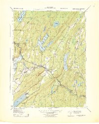
1943 Map of Newfoundland
USGS Topo · Published 1943About this map
The Pequannock River valley serves as the central corridor for this mid-century survey, where the New York Susquehanna and Western railroad tracks parallel the water through the village of Newfoundland. The landscape is dominated by heavy water-management infrastructure, notably the Clinton Reservoir and Canistear Reservoir, which reflect the region's role in the Newark Water Supply system. Along the valley floor, the settlements of Oak Ridge and Charlottesburg mark historic transit points between the steep ridges of Bearfort Mountain and Kanouse Mountain.
Find a feature on this map
42 named features on this map. Tap any name to fly to it.
Don’t see what you’re looking for? This feature index may not catch every label — zoom into the map to look around manually.
Map Details
Editions of this 1943 Newfoundland Map
This is the sole edition of this map. No revisions or reprints were ever made.
Other maps of this area

1888 · Franklin
USGS Topo · 1:62,500

1888 · Morristown
USGS Topo · 1:62,500

1888 · Lake Hopatcong
USGS Topo · 1:62,500

1891 · Greenwood Lake
USGS Topo · 1:62,500

1893 · Greenwood Lake
USGS Topo · 1:62,500

1894 · Morristown
USGS Topo · 1:62,500

1894 · Lake Hopatcong
USGS Topo · 1:62,500

1894 · Franklin
USGS Topo · 1:62,500

1897 · Franklin
USGS Topo · 1:62,500

1898 · Lake Hopatcong
USGS Topo · 1:62,500