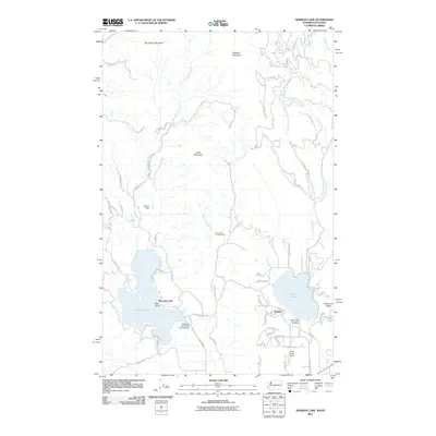
2011 Map of Newman Lake
USGS Topo · Published 2011About this map
Newman Lake and Hauser Lake dominate this landscape on the Washington-Idaho border, where water management and recreation define the local geography. The area's hydraulic history is visible through infrastructure like Warner Dam and the Newman Lake Flood Control Dam, while public recreation is anchored by the Homestead Campground and the Hauser Lake Access Fish and Game area. The settlement of Hauser sits at the foot of Eisenhour Ridge, showing a transition from the lakeside residential pockets to the higher elevations of Round Top Mountain and Ragged Mountain. Aviation interests are represented by the Smith Ranch Airport to the south. This map details the complex network of mountain creeks, such as Shaw Creek and the various forks of Hauser Creek, which feed the prominent basins.
Find a feature on this map
64 named features on this map. Tap any name to fly to it.
Don’t see what you’re looking for? This feature index may not catch every label — zoom into the map to look around manually.
Map Details
Editions of this 2011 Newman Lake Map
This is the sole edition of this map. No revisions or reprints were ever made.
Other maps of this area

1901 · Spokane
USGS Topo · 1:125,000

1903 · Rathdrum
USGS Topo · 1:125,000

1943 · Mt Spokane
USGS Topo · 1:62,500

1949 · Greenacres
USGS Topo · 1:62,500

1950 · Mt Spokane
USGS Topo · 1:62,500

1951 · Greenacres
USGS Topo · 1:62,500

1955 · Spokane
USGS Topo · 1:250,000

1957 · Coeur D'Alene
USGS Topo · 1:62,500

1958 · Spokane
USGS Topo · 1:250,000

1961 · Rathdrum
USGS Topo · 1:24,000