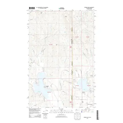
2014 Map of Newman Lake
USGS Topo · Published 2014About this map
Newman Lake and Hauser Lake dominate this landscape straddling the border of Spokane County, Washington, and Kootenai County, Idaho. The settlement of Hauser sits at the edge of the Rathdrum Prairie, a broad expanse that transitions abruptly into the high peaks of Round Top Mtn, Ragged Mtn, and Green Mtn. In the early 21st century, these mountains remain heavily dissected by drainages like Schackle Cr and Shaw Cr. Local aviation and recreation are marked by features such as the Smith Ranch Airport and the Hauser Lake Access Fish and Game area. Residential development is clustered along the lakefronts, notably at Bass Point and along E Park Beach Rd, while the higher elevations are accessed by a network of timber and ridge roads, including N Ragged Ridge Rd. Small, tucked-away water bodies like Lost Lake provide evidence of the complex glacial topography of the Inland Northwest.
Find a feature on this map
73 named features on this map. Tap any name to fly to it.
Don’t see what you’re looking for? This feature index may not catch every label — zoom into the map to look around manually.
Map Details
Editions of this 2014 Newman Lake Map
This is the sole edition of this map. No revisions or reprints were ever made.
Other maps of this area

1901 · Spokane
USGS Topo · 1:125,000

1903 · Rathdrum
USGS Topo · 1:125,000

1943 · Mt Spokane
USGS Topo · 1:62,500

1949 · Greenacres
USGS Topo · 1:62,500

1950 · Mt Spokane
USGS Topo · 1:62,500

1951 · Greenacres
USGS Topo · 1:62,500

1955 · Spokane
USGS Topo · 1:250,000

1957 · Coeur D'Alene
USGS Topo · 1:62,500

1958 · Spokane
USGS Topo · 1:250,000

1961 · Rathdrum
USGS Topo · 1:24,000