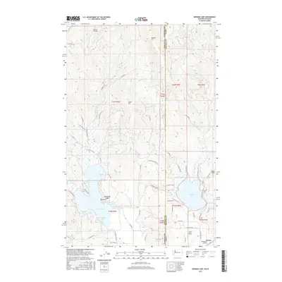
2017 Map of Newman Lake
USGS Topo · Published 2017About this map
Newman Lake and Hauser Lake dominate this borderland landscape where the high peaks of the Selkirk foothills meet the broad Rathdrum Prairie. The map illustrates a densely identified shoreline community at Newman Lake, characterized by numerous named coves and points such as Honeymoon Bay, Cherokee Bay, and Bass Point. These features suggest a long-established recreational and residential pattern tied to the water. To the east, the state line between Washington and Idaho bisects the terrain, separating the more mountainous reaches of Ragged Mtn and Round Top Mtn from the flatter valley floor near Hauser. The presence of the Smith Ranch Airport and the transition from rugged slopes to the agricultural expanse of the prairie highlights the intersection of aviation, timber, and rural development. Smaller water bodies like Lost Lake and various seasonal drainages such as Schackie Cr further define the local hydrology of the Spokane-Kootenai county line area.
Find a feature on this map
76 named features on this map. Tap any name to fly to it.
Don’t see what you’re looking for? This feature index may not catch every label — zoom into the map to look around manually.
Map Details
Editions of this 2017 Newman Lake Map
This is the sole edition of this map. No revisions or reprints were ever made.
Other maps of this area

1901 · Spokane
USGS Topo · 1:125,000

1903 · Rathdrum
USGS Topo · 1:125,000

1943 · Mt Spokane
USGS Topo · 1:62,500

1949 · Greenacres
USGS Topo · 1:62,500

1950 · Mt Spokane
USGS Topo · 1:62,500

1951 · Greenacres
USGS Topo · 1:62,500

1955 · Spokane
USGS Topo · 1:250,000

1957 · Coeur D'Alene
USGS Topo · 1:62,500

1958 · Spokane
USGS Topo · 1:250,000

1961 · Rathdrum
USGS Topo · 1:24,000