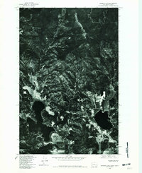
1978 Map of Newman Lake
USGS Topo · Published 1981About this map
Newman Lake anchors the southern portion of this Washington-Idaho borderlands landscape, captured during a 1978 aerial survey. The orthophoto format provides a direct photographic view of the transition from the flat agricultural fields at the lake's southern tip to the heavily forested slopes of Ragged Mountain and Green Mountain to the north. These peaks define the local topography, showing the density of the timber and the complex network of access roads and clearings that existed in the late 1970s. This imagery is particularly valuable for documenting the precise footprint of development around the shoreline and the extent of logging or fire breaks in the higher elevations before decades of subsequent growth and forest management changed the canopy.
Find a feature on this map
3 named features on this map. Tap any name to fly to it.
Don’t see what you’re looking for? This feature index may not catch every label — zoom into the map to look around manually.
Map Details
Editions of this 1978 Newman Lake Map
This is the sole edition of this map. No revisions or reprints were ever made.
Other maps of this area

1901 · Spokane
USGS Topo · 1:125,000

1903 · Rathdrum
USGS Topo · 1:125,000

1943 · Mt Spokane
USGS Topo · 1:62,500

1949 · Greenacres
USGS Topo · 1:62,500

1950 · Mt Spokane
USGS Topo · 1:62,500

1951 · Greenacres
USGS Topo · 1:62,500

1955 · Spokane
USGS Topo · 1:250,000

1957 · Coeur D'Alene
USGS Topo · 1:62,500

1958 · Spokane
USGS Topo · 1:250,000

1961 · Rathdrum
USGS Topo · 1:24,000