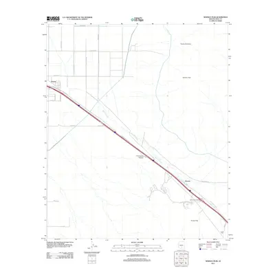
2011 Map of Newman Peak
USGS Topo · Published 2011About this map
Picacho sits at the base of the Picacho Mountains in this 2011 survey, a landscape defined by the convergence of desert drainage systems and modern transportation corridors. The dominant topographical feature is Newman Peak, which towers over the surrounding basin, while the narrow corridor of Picacho Pass serves as a historic transit point. The map illustrates the path of McClellan Wash as it flows parallel to the interstate, weaving through a grid of rural roads like E Milligan Rd and S Wheeler Rd. Near the southern edge of the quadrangle, the settlement of Wymola is positioned near the Picacho Peak Interchange, reflecting the area's development around key highway infrastructure. The presence of the Arizona Highway Department Rest Area and a network of arterial roads like E Camino Adelante Dr indicates how this segment of the Sonoran Desert has been adapted for regional connectivity.
Find a feature on this map
31 named features on this map. Tap any name to fly to it.
Don’t see what you’re looking for? This feature index may not catch every label — zoom into the map to look around manually.
Map Details
Editions of this 2011 Newman Peak Map
This is the sole edition of this map. No revisions or reprints were ever made.
Other maps of this area

1922 · Red Rock No 2
USGS Topo · 1:48,000

1922 · Signal Peak
USGS Topo · 1:62,500

1924 · Signal Peak
USGS Topo · 1:62,500

1934 · Newman Peak
USGS Topo · 1:125,000

1947 · Red Rock
USGS Topo · 1:62,500

1947 · Eloy
USGS Topo · 1:62,500

1948 · Eloy
USGS Topo · 1:62,500

1956 · Tucson
USGS Topo · 1:250,000

1958 · Tucson
USGS Topo · 1:250,000

1959 · Tucson
USGS Topo · 1:250,000