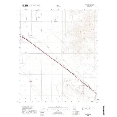
2018 Map of Newman Peak
USGS Topo · Published 2018About this map
Newman Peak and the surrounding Picacho Mountains dominate the eastern half of this landscape, rising sharply from the desert floor. The area is defined by its vital water infrastructure and transportation corridors, with the Central Arizona Project Aqueduct and the Central Main Canal cutting through the arid terrain to support local agriculture and industry. To the south, the iconic profile of Picacho Peak stands near the small settlement of Wymola, while the community of Picacho sits adjacent to a major diagonal road network. The map reveals the stark contrast between the natural drainage of McClellan Wash and the rigid, engineered grid of irrigation and transport that enables life in this portion of Pinal County. A corner of Eloy appears in the northwest, showing the beginning of a dense street plan that extends into the irrigated flats.
Find a feature on this map
35 named features on this map. Tap any name to fly to it.
Don’t see what you’re looking for? This feature index may not catch every label — zoom into the map to look around manually.
Map Details
Editions of this 2018 Newman Peak Map
This is the sole edition of this map. No revisions or reprints were ever made.
Other maps of this area

1922 · Red Rock No 2
USGS Topo · 1:48,000

1922 · Signal Peak
USGS Topo · 1:62,500

1924 · Signal Peak
USGS Topo · 1:62,500

1934 · Newman Peak
USGS Topo · 1:125,000

1947 · Red Rock
USGS Topo · 1:62,500

1947 · Eloy
USGS Topo · 1:62,500

1948 · Eloy
USGS Topo · 1:62,500

1956 · Tucson
USGS Topo · 1:250,000

1958 · Tucson
USGS Topo · 1:250,000

1959 · Tucson
USGS Topo · 1:250,000