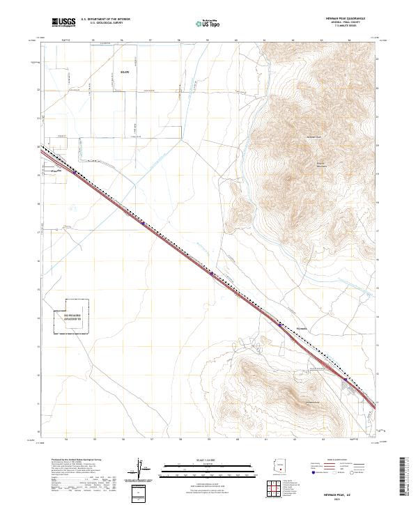
2021 Map of Newman Peak
USGS Topo · Published 2021About this map
Newman Peak and the surrounding Picacho Mountains dominate this Pinal County landscape, rising sharply from the desert floor. The area is defined by the intersection of major water infrastructure and transportation corridors, with the Central Arizona Project Aqueduct and Central Main Canal cutting through the arid terrain. These engineering feats run parallel to established settlements like Eloy and the community of Picacho, which are centered around the thoroughfare of E Camino Adelante Rd. In the south, Picacho Peak stands as a prominent landmark near the smaller siding of Wymola. The map illustrates the stark contrast between the precision of modern irrigation and the natural desert drainage of McClellan Wash, which meanders across the plain between the mountain ranges. A dense grid of rural roads, including E Milligan Rd and Wheeler Rd, reveals the organized agricultural and residential footprint spread across the valley.
Find a feature on this map
33 named features on this map. Tap any name to fly to it.
Don’t see what you’re looking for? This feature index may not catch every label — zoom into the map to look around manually.
Map Details
Editions of this 2021 Newman Peak Map
This is the sole edition of this map. No revisions or reprints were ever made.
Other maps of this area

1922 · Red Rock No 2
USGS Topo · 1:48,000

1922 · Signal Peak
USGS Topo · 1:62,500

1924 · Signal Peak
USGS Topo · 1:62,500

1934 · Newman Peak
USGS Topo · 1:125,000

1947 · Red Rock
USGS Topo · 1:62,500

1947 · Eloy
USGS Topo · 1:62,500

1948 · Eloy
USGS Topo · 1:62,500

1956 · Tucson
USGS Topo · 1:250,000

1958 · Tucson
USGS Topo · 1:250,000

1959 · Tucson
USGS Topo · 1:250,000