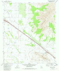
1981 Map of Newman Peak
USGS Topo · Published 1982About this map
Newman Peak and the high ridges of the Picacho Mountains dominate this arid landscape between Phoenix and Tucson. The corridor through the flats is a busy artery of transportation, defined by the Southern Pacific railroad and the modern Picacho Peak Interchange. In the shadow of Picacho Peak, Picacho Peak State Park provides structured recreation and preservation, including Historical Monuments that reflect the area's significance. Small desert settlements and stopovers like Picacho, Ocotillo, and Wymola dot the rail line, while the Marana Auxiliary Landing Field and a nearby Landing Strip indicate the region's importance for aviation. This 1981 survey effectively captures the balance between the preserve's natural relief and the industrial infrastructure following the McClellan Wash.
Find a feature on this map
23 named features on this map. Tap any name to fly to it.
Don’t see what you’re looking for? This feature index may not catch every label — zoom into the map to look around manually.
Map Details
Editions of this 1981 Newman Peak Map
This is the sole edition of this map. No revisions or reprints were ever made.
Other maps of this area

1922 · Red Rock No 2
USGS Topo · 1:48,000

1922 · Signal Peak
USGS Topo · 1:62,500

1924 · Signal Peak
USGS Topo · 1:62,500

1934 · Newman Peak
USGS Topo · 1:125,000

1947 · Red Rock
USGS Topo · 1:62,500

1947 · Eloy
USGS Topo · 1:62,500

1948 · Eloy
USGS Topo · 1:62,500

1956 · Tucson
USGS Topo · 1:250,000

1958 · Tucson
USGS Topo · 1:250,000

1959 · Tucson
USGS Topo · 1:250,000