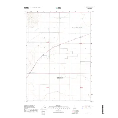
2020 Map of Nichols Reservoir
USGS Topo · Published 2020About this map
Craters Of The Moon National Preserve occupies the southern half of this landscape, marking a stark volcanic interface with the agricultural and riparian systems to the north. Located in the Big Lost River Valley, the area is defined by its water management and drainage patterns. The northern reaches show an organized grid of section lines and water infrastructure, including the Blaine Canal and Moore Canal, which draw from the regional watershed to support the valley floor. To the west, the terrain rises toward several seasonal watercourses and local landmarks like Tephick Spring. The map documents the specific boundary where the protected volcanic wilderness meets the human-managed landscape of Butte County, Idaho. Minor drainages such as Timbered Dome Cr and Champagne Cr provide essential topographical detail for understanding the local hydrology and its relation to the highway corridors that traverse the valley.
Find a feature on this map
11 named features on this map. Tap any name to fly to it.
Don’t see what you’re looking for? This feature index may not catch every label — zoom into the map to look around manually.
Map Details
Editions of this 2020 Nichols Reservoir Map
This is the sole edition of this map. No revisions or reprints were ever made.
Other maps of this area

1935 · MacKay
USGS Topo · 1:96,000

1955 · Idaho Falls
USGS Topo · 1:250,000

1958 · Idaho Falls
USGS Topo · 1:250,000

1960 · Grouse
USGS Topo · 1:62,500

1972 · Arco North
USGS Topo · 1:24,000

1972 · Arco South
USGS Topo · 1:24,000

1972 · Nichols Reservoir
USGS Topo · 1:24,000

1972 · Fingers Butte
USGS Topo · 1:24,000

1972 · Inferno Cone
USGS Topo · 1:24,000

1972 · Appendicitis Hill
USGS Topo · 1:24,000