2024 Map of Nicholson
USGS Topo · Published 2024About this map
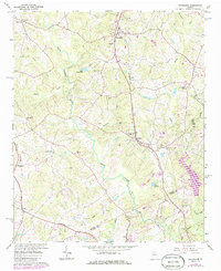
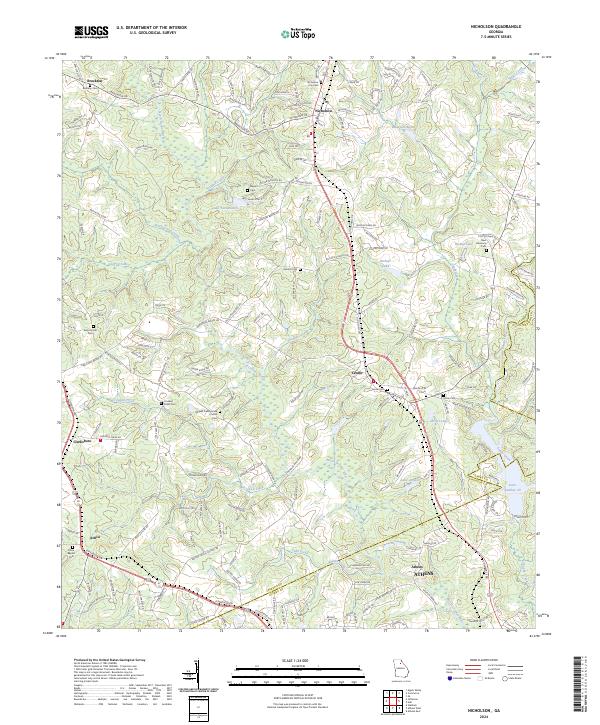
The North Oconee River serves as a geographic spine for this portion of Jackson and Clarke counties, where agricultural roots remain visible through a dense network of country churches and family burial grounds. The landscape is dotted with generational landmarks such as the Mizpah Presbyterian Church and the nearby Mizpah Cem, alongside historical congregations at Antioch Ch. Small communities like Nicholson, Center, and Brockton are defined by their proximity to water bodies like Lake Yamacutah and Bishops Lake. The presence of numerous small cemeteries, including New Harmony Cem and Nimho A M E Cem, provides significant detail for researchers tracing local families. This modern survey reflects the enduring rural character of the region as it transitions toward the northern outskirts of Athens.
Find a feature on this map
167 named features on this map. Tap any name to fly to it.
Don’t see what you’re looking for? This feature index may not catch every label — zoom into the map to look around manually.
Map Details
Editions of this 2024 Nicholson Map
This is the sole edition of this map. No revisions or reprints were ever made.