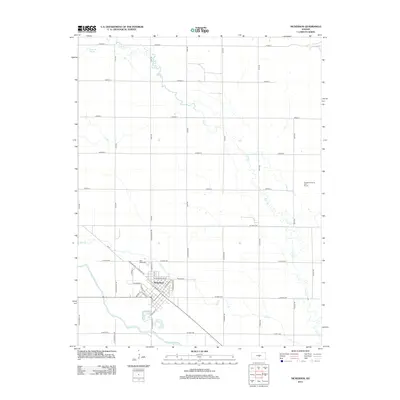
2012 Map of Nickerson
USGS Topo · Published 2012About this map
Nickerson serves as the central hub of this Reno County landscape, where the town's diagonal street grid contrasts with the rigid cardinal orientation of the surrounding rural section lines. The settlement is positioned north of the winding Arkansas River, with the local Post Office and a network of avenues such as W Avenue A and N Nickerson Blvd defining the community's layout. The surrounding terrain is heavily influenced by hydrological features, notably the Santa Fe Slough to the northwest and the meandering paths of Cow Creek, Dry Creek, and Bull Creek that drain toward the river.
Find a feature on this map
48 named features on this map. Tap any name to fly to it.
Don’t see what you’re looking for? This feature index may not catch every label — zoom into the map to look around manually.
Map Details
Editions of this 2012 Nickerson Map
This is the sole edition of this map. No revisions or reprints were ever made.
Other maps of this area

1891 · Hutchinson
USGS Topo · 1:125,000

1893 · Hutchinson
USGS Topo · 1:125,000

1894 · Lyons
USGS Topo · 1:125,000

1955 · Great Bend
USGS Topo · 1:250,000

1955 · Hutchinson
USGS Topo · 1:250,000

1957 · Great Bend
USGS Topo · 1:250,000

1958 · Great Bend
USGS Topo · 1:250,000

1959 · Hutchinson
USGS Topo · 1:250,000

1960 · Yaggy
USGS Topo · 1:24,000
1960 · Hutchinson
USGS Topo · 1:24,000