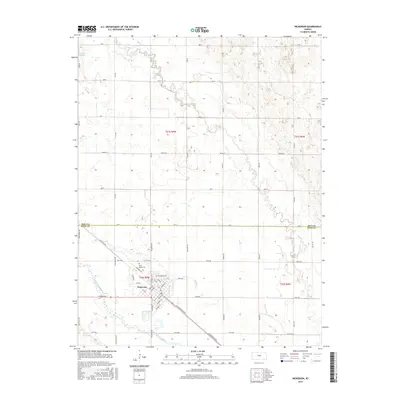
2015 Map of Nickerson
USGS Topo · Published 2015About this map
The Arkansas River and its intricate drainage systems define the landscape of Reno and Rice counties in this mid-2010s survey. The city of Nickerson serves as the central hub, situated near the riverbanks where Nickerson Blvd and Railroad Ave trace the historic transit corridors that shaped the town's grid. The surrounding prairie is marked by a precise network of section roads, including Ave Y, which follows the boundary between Rice and Reno counties. This map provides significant detail for local historians, documenting the Wild Mead Cem north of town and the winding paths of Bull Cr, Cow Cr, and Santa Fe Slough, which illustrate the hydrological character of the central Kansas plains.
Find a feature on this map
57 named features on this map. Tap any name to fly to it.
Don’t see what you’re looking for? This feature index may not catch every label — zoom into the map to look around manually.
Map Details
Editions of this 2015 Nickerson Map
This is the sole edition of this map. No revisions or reprints were ever made.
Other maps of this area

1891 · Hutchinson
USGS Topo · 1:125,000

1893 · Hutchinson
USGS Topo · 1:125,000

1894 · Lyons
USGS Topo · 1:125,000

1955 · Great Bend
USGS Topo · 1:250,000

1955 · Hutchinson
USGS Topo · 1:250,000

1957 · Great Bend
USGS Topo · 1:250,000

1958 · Great Bend
USGS Topo · 1:250,000

1959 · Hutchinson
USGS Topo · 1:250,000

1960 · Yaggy
USGS Topo · 1:24,000
1960 · Hutchinson
USGS Topo · 1:24,000