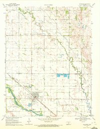
1970 Map of Nickerson
USGS Topo · Published 1972About this map
Nickerson serves as the central hub of this 1970 landscape, situated at the intersection of significant rail lines and water routes. The town is flanked by the Arkansas River to the south and Cow Creek to the north, creating a corridor for the Atchison Topeka and Pacific Santa Fe railroad. To the west, Salt Creek joins the Arkansas, while the northern sections are dominated by the extensive Wherry Oil Field and Dymond Oil Field.
Find a feature on this map
23 named features on this map. Tap any name to fly to it.
Don’t see what you’re looking for? This feature index may not catch every label — zoom into the map to look around manually.
Map Details
Editions of this 1970 Nickerson Map
This is the sole edition of this map. No revisions or reprints were ever made.
Other maps of this area

1891 · Hutchinson
USGS Topo · 1:125,000

1893 · Hutchinson
USGS Topo · 1:125,000

1894 · Lyons
USGS Topo · 1:125,000

1955 · Great Bend
USGS Topo · 1:250,000

1955 · Hutchinson
USGS Topo · 1:250,000

1957 · Great Bend
USGS Topo · 1:250,000

1958 · Great Bend
USGS Topo · 1:250,000

1959 · Hutchinson
USGS Topo · 1:250,000

1960 · Yaggy
USGS Topo · 1:24,000
1960 · Hutchinson
USGS Topo · 1:24,000