2022 Map of Nicut
USGS Topo · Published 2022About this map
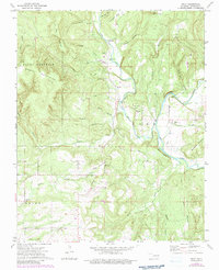
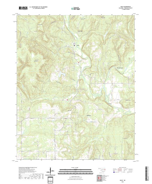
Nicut and Belfonte anchor this rural landscape in the eastern Ozark foothills of Sequoyah County, where the terrain is defined by a dense network of hollows and ridges. Waterways such as Little Lee Creek and Salt Cr have carved deep paths through the Brushy Mountains, creating landmarks like Star Bluff and Copic Slab. This 2022 survey details the enduring topographic character of the region, emphasizing the relief between high points like Blackbird Mtn and the low-lying Procter Hollow and Dead Man Hollow.
Find a feature on this map
83 named features on this map. Tap any name to fly to it.
Don’t see what you’re looking for? This feature index may not catch every label — zoom into the map to look around manually.
Map Details
Editions of this 2022 Nicut Map
This is the sole edition of this map. No revisions or reprints were ever made.