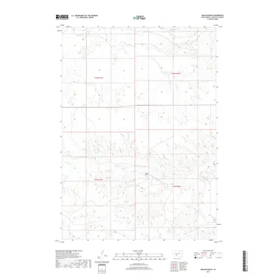
2017 Map of Nielson Ranch
USGS Topo · Published 2017About this map
Nielson Ranch serves as a lone named landmark within this expanse of the Great Plains in Mellette County. The landscape is defined by the branching drainage systems of Pine Creek, which includes the N Br Pine Cr and S Br Pine Cr. These waterways cut through the prairie, creating a network of draws and intermittent streams that reveal the topographic complexity of the Swift Bear Segment. To the north, Cottonwood Cr crosses the township boundaries of t42n r31w and t42n r30w. This survey is a record of land use and water resources in a sparsely settled ranching region, where the legal township grid and natural hydrology are the primary organizing features of the territory.
Find a feature on this map
9 named features on this map. Tap any name to fly to it.
Don’t see what you’re looking for? This feature index may not catch every label — zoom into the map to look around manually.
Map Details
Editions of this 2017 Nielson Ranch Map
This is the sole edition of this map. No revisions or reprints were ever made.
Other maps of this area

1951 · Cedar Butte NE
USGS Topo · 1:24,000

1951 · Murdo 3 NW
USGS Topo · 1:24,000

1951 · Murdo 3 NE
USGS Topo · 1:24,000

1955 · Martin
USGS Topo · 1:250,000

1958 · Martin
USGS Topo · 1:250,000

1969 · Soldier Creek NE
USGS Topo · 1:24,000

1969 · Parmelee NE
USGS Topo · 1:24,000

1969 · Soldier Creek NW
USGS Topo · 1:24,000

1980 · Kadoka
USGS Topo · 1:100,000

1981 · Cedar Butte
USGS Topo · 1:25,000