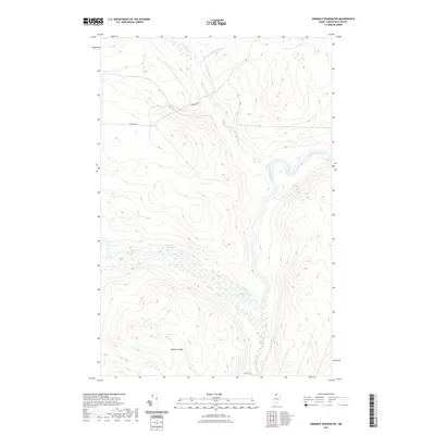
2021 Map of Ninemile Deadwater
USGS Topo · Published 2021About this map
The Big Black River meanders through this remote portion of Aroostook County, forming the prominent Ninemile Deadwater as it flows toward the Canadian border. This landscape is defined by its deep woods and substantial elevation changes, most notably at Western Ledge, where the terrain rises sharply from the river valley. The map documents a sparsely developed territory where infrastructure is limited to essential timber and access routes like Robinson Rd and Escourt Rd. Small waterways including Fivemile Brook and its unnamed branch, Br of Fivemile Brook, drain the uplands into the river system. The presence of these named landings and primitive roads indicates a landscape managed for forestry and traditional North Woods passage, preserved here in its early 21st-century state.
Find a feature on this map
8 named features on this map. Tap any name to fly to it.
Don’t see what you’re looking for? This feature index may not catch every label — zoom into the map to look around manually.
Map Details
Editions of this 2021 Ninemile Deadwater Map
This is the sole edition of this map. No revisions or reprints were ever made.
Other maps of this area

1954 · Presque Isle
USGS Topo · 1:250,000

1955 · Rocky Mountain
USGS Topo · 1:62,500

1955 · Little East Lake
USGS Topo · 1:62,500

1955 · Round Pond
USGS Topo · 1:62,500

1955 · Seven Islands
USGS Topo · 1:62,500

1958 · Presque Isle
USGS Topo · 1:250,000

1960 · Presque Isle
USGS Topo · 1:250,000

1962 · Edmundston
USGS Topo · 1:250,000

1976 · Seven Islands
USGS Topo · 1:24,000

1976 · East Lake SE
USGS Topo · 1:24,000