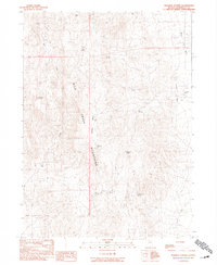
1990 Map of Ninemile Summit
USGS Topo · Published 1990About this map
The Basque Mountains dominate this high-desert landscape in northern Nevada, serving as a critical water source for the surrounding arid basins. The distribution of perennial water is meticulously documented through a network of springs, including Agate Spring, Basque Spring, and Dacite Spring, which supported the livestock operations of the late twentieth century. In the eastern reaches, the terrain descends into the Kings River Valley, where the Nine Mile Ranch stands as a primary marker of human activity and settlement in this isolated region. The presence of features like Table Mountain and Ninemile Summit illustrates the dramatic vertical relief of the Great Basin. This provisional survey provides a precise record of the land use patterns and vital water locations like Mud Spring and Ninemile Springs before the turn of the millennium.
Find a feature on this map
18 named features on this map. Tap any name to fly to it.
Don’t see what you’re looking for? This feature index may not catch every label — zoom into the map to look around manually.
Map Details
Editions of this 1990 Ninemile Summit Map
This is the sole edition of this map. No revisions or reprints were ever made.
Other maps of this area

1886 · Disaster
USGS Topo · 1:250,000

1893 · Disaster
USGS Topo · 1:250,000

1954 · Vya
USGS Topo · 1:250,000

1958 · Vya
USGS Topo · 1:250,000

1961 · Quinn River Crossing
USGS Topo · 1:62,500

1961 · Thacker Pass
USGS Topo · 1:62,500

1961 · Trident Peak
USGS Topo · 1:62,500

1961 · Disaster Peak
USGS Topo · 1:62,500

1962 · Vya
USGS Topo · 1:250,000

1979 · Denio
USGS Topo · 1:100,000