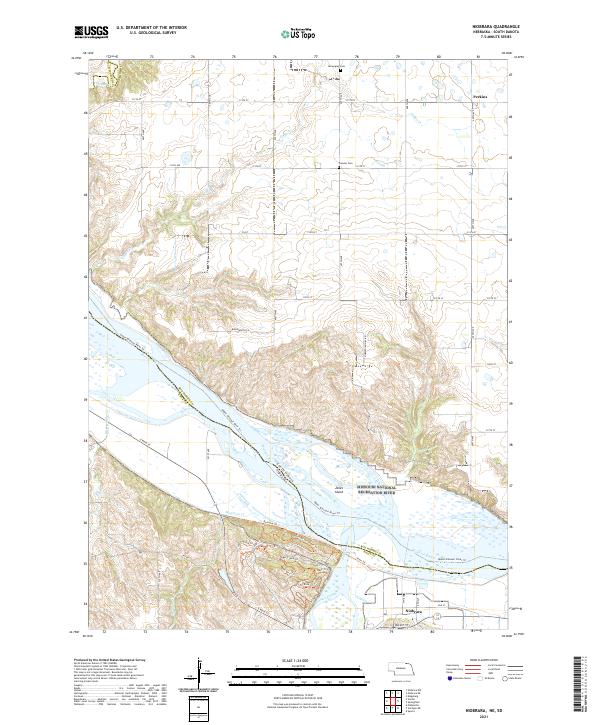
2021 Map of Niobrara
USGS Topo · Published 2021About this map
Niobrara sits at the confluence of major waterways where the Niobrara Wild and Scenic River joins the Missouri National Recreation River. This landscape is defined by the shifting channels and sandbars surrounding Jones Island, where the state line between South Dakota and Nebraska follows the old river course. To the north, the terrain transitions into the high plains of the Perkins area, characterized by a grid of rural roads and established landmarks like Pioneer Cem and Norwegian Cem. The riverfront is highly accessible through an intricate network of local paths, including the George Drouillard Trl, Railroad Trl, and the Upper Missouri River Trl. These trails, along with numerous family-named landmarks such as Harry Miller Cr and Woodworth Ln, reflect a deep history of navigation and early prairie settlement in Knox County and across the river in South Dakota.
Find a feature on this map
54 named features on this map. Tap any name to fly to it.
Don’t see what you’re looking for? This feature index may not catch every label — zoom into the map to look around manually.
Map Details
Editions of this 2021 Niobrara Map
This is the sole edition of this map. No revisions or reprints were ever made.
Other maps of this area

1950 · Niobrara
USGS Topo · 1:24,000

1950 · Verdel
USGS Topo · 1:24,000

1950 · Verdigre NE
USGS Topo · 1:24,000

1950 · Pishelville
USGS Topo · 1:24,000

1955 · Sioux City
USGS Topo · 1:250,000

1955 · O'Neill
USGS Topo · 1:250,000

1958 · Sioux City
USGS Topo · 1:250,000

1959 · O'Neill
USGS Topo · 1:250,000

1959 · Sioux City
USGS Topo · 1:250,000

1969 · O'Neill
USGS Topo · 1:250,000