1977 Map of Niobrara
USGS Topo · Published 1977About this map
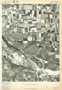
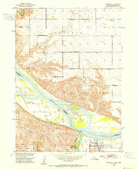
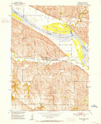
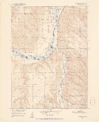
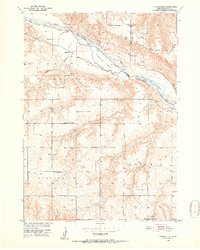
Niobrara sits at the significant confluence of two major waterways on this 1977 orthophotograph, where the Niobrara River meets the braided channels of the Missouri River. This advance print, produced by the Geological Survey in cooperation with the Bureau of Indian Affairs, provides an aerial perspective of the landscape straddling the Nebraska and South Dakota border. The image reveals a stark transition from the complex, silt-laden river bottoms to the highly structured agricultural grid of the uplands, including the high ground of Perkins. The presence of Choteau Cr in the northwestern corner further highlights the drainage patterns that have shaped this borderland territory. This specific edition captures the town and its surrounding fields as they appeared in the late 1970s, documenting the river's path before shifting currents or further development altered the shoreline.
Find a feature on this map
5 named features on this map. Tap any name to fly to it.
Don’t see what you’re looking for? This feature index may not catch every label — zoom into the map to look around manually.
Map Details
Editions of this 1977 Niobrara Map
This is the sole edition of this map. No revisions or reprints were ever made.
Other maps of this area
1950 · Niobrara
USGS Topo · 1:24,000
1950 · Verdel
USGS Topo · 1:24,000
1950 · Verdigre NE
USGS Topo · 1:24,000
1950 · Pishelville
USGS Topo · 1:24,000

1955 · Sioux City
USGS Topo · 1:250,000

1955 · O'Neill
USGS Topo · 1:250,000

1958 · Sioux City
USGS Topo · 1:250,000

1959 · O'Neill
USGS Topo · 1:250,000

1959 · Sioux City
USGS Topo · 1:250,000

1969 · O'Neill
USGS Topo · 1:250,000
Featured Places
- Niobrara, NE
- Running Water Township, SD
- Rouse Township, SD
- Hancock Township, SD
- Perkins, Hancock Township