
1950 Map of Pishelville
USGS Topo · Published 1952About this map
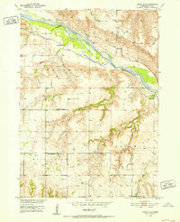
The Niobrara River carves a significant path through this Knox County landscape, creating the large Pishelville Island and shaping the development of the surrounding river breaks. During this mid-century period, the area maintained a network of small, rural schools that anchored the local townships, including Berg Sch in Raymond and Cottonwood Row Sch near the settlement of Jelen. The topography is defined by significant elevation changes between the river valley and landmarks like Stony Butte, illustrating the challenges of 1950s agriculture and road building in northern Nebraska. Small communities such as Pishelville and Dukeville serve as focal points for the surrounding farmsteads, while the National Cem and Riverview Cem provide important genealogical touchstones for families settled within Western and Bohemia townships.
Find a feature on this map
20 named features on this map. Tap any name to fly to it.
Don’t see what you’re looking for? This feature index may not catch every label — zoom into the map to look around manually.
Map Details
Editions of this 1950 Pishelville Map
2 editions found
Other maps of this area

1950 · Niobrara
USGS Topo · 1:24,000

1950 · Verdel
USGS Topo · 1:24,000

1950 · Verdigre NE
USGS Topo · 1:24,000

1950 · Monowi
USGS Topo · 1:24,000

1952 · Monowi
USGS Topo · 1:24,000

1952 · Dorsey
USGS Topo · 1:24,000

1954 · Walnut
USGS Topo · 1:24,000

1954 · Verdigre
USGS Topo · 1:24,000

1954 · Star
USGS Topo · 1:24,000

1955 · O'Neill
USGS Topo · 1:250,000