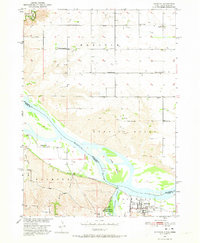
1950 Map of Niobrara
USGS Topo · Published 1973About this map
The confluence of the Missouri River and Niobrara River defines this 1950 survey, capturing a landscape of braided channels and floodplain islands like Jones Island. Along the southern bank, the town of Niobrara sits adjacent to the expansive Niobrara State Park, while the Chicago and North Western railroad traces the river's path through the Raymond township.
Find a feature on this map
26 named features on this map. Tap any name to fly to it.
Don’t see what you’re looking for? This feature index may not catch every label — zoom into the map to look around manually.
Map Details
Editions of this 1950 Niobrara Map
2 editions found
Other maps of this area

1950 · Niobrara
USGS Topo · 1:24,000

1950 · Verdel
USGS Topo · 1:24,000

1950 · Verdigre NE
USGS Topo · 1:24,000

1950 · Pishelville
USGS Topo · 1:24,000

1955 · Sioux City
USGS Topo · 1:250,000

1955 · O'Neill
USGS Topo · 1:250,000

1958 · Sioux City
USGS Topo · 1:250,000

1959 · O'Neill
USGS Topo · 1:250,000

1959 · Sioux City
USGS Topo · 1:250,000

1969 · O'Neill
USGS Topo · 1:250,000