2022 Map of Nocona
USGS Topo · Published 2022About this map
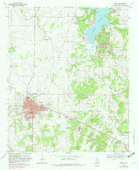
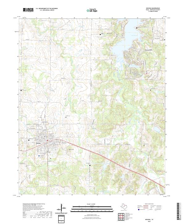
The town of Nocona serves as the focal point of this northern Montague County landscape, showing its organized street grid and the Nocona Cem on its western edge. North of the city center, the terrain shifts toward the shores of Lake Nocona, where the residential developments of Nocona Hills and Leisure Lake illustrate the area's twentieth-century growth. This recreation-centered expansion is characterized by winding roads with names like Cherokee Trl and Apache Trl, contrasting with the traditional rural layout of the surrounding plains.
Find a feature on this map
132 named features on this map. Tap any name to fly to it.
Don’t see what you’re looking for? This feature index may not catch every label — zoom into the map to look around manually.
Map Details
Editions of this 2022 Nocona Map
This is the sole edition of this map. No revisions or reprints were ever made.