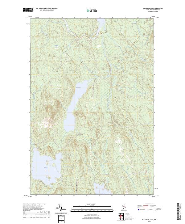
2024 Map of Nollesemic Lake
USGS Topo · Published 2024About this map
Nollesemic Lake sits at the center of this Maine landscape, part of a complex hydrological network within Penobscot County. The surrounding terrain is defined by a series of interconnected bogs and streams, including Quakish Bog to the northwest and the distinctive Miner Brook-Bog in the northeast. The West Branch Penobscot River cuts across the northern section of the map, featuring the notable Grand Falls. To the south, the waters of East Branch Lake and Mattamiscontis Lake suggest a region shaped by glacial recession and drainage. The sparse road network, consisting of Nollesemic Rd and Moose Ridge Rd, highlights the primary access points through this heavily timbered and water-rich territory, while smaller tributaries like Sam Ayers Stream and Trapper Brook feed into the larger basins.
Find a feature on this map
18 named features on this map. Tap any name to fly to it.
Don’t see what you’re looking for? This feature index may not catch every label — zoom into the map to look around manually.
Map Details
Editions of this 2024 Nollesemic Lake Map
This is the sole edition of this map. No revisions or reprints were ever made.
Other maps of this area

1942 · Lincoln
USGS Topo · 1:62,500

1947 · Schoodic
USGS Topo · 1:62,500

1949 · Schoodic
USGS Topo · 1:62,500

1951 · Norcross
USGS Topo · 1:62,500

1951 · Millinocket
USGS Topo · 1:62,500

1954 · Millinocket
USGS Topo · 1:250,000

1957 · Lincoln
USGS Topo · 1:62,500

1958 · Millinocket
USGS Topo · 1:250,000

1960 · Millinocket
USGS Topo · 1:250,000

1975 · Millinocket SW
USGS Topo · 1:24,000