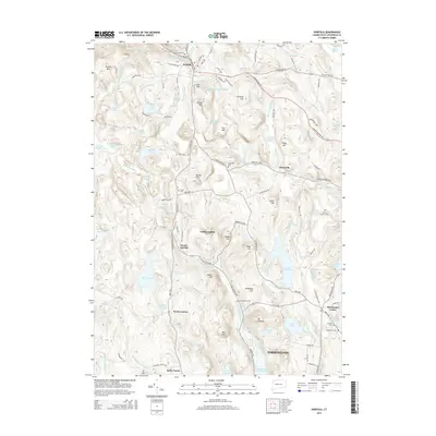
2015 Map of Norfolk
USGS Topo · Published 2015About this map
Norfolk sits at the northern edge of this Litchfield County survey, situated amidst a landscape of steep hills and glacial ponds. The settlement pattern reflects the complex topography of the Berkshire foothills, where historic village centers like Winchester Center and Grantville are connected by winding valley roads. The southern portion of the map transitions into the northern extent of Torrington, showing the expansion of the city toward the more rural uplands. This 2015 edition provides a precise look at the modern road network, including Route 44 and Route 272, as they navigate the ridges and hollows that historically defined the region's movement and early industrial development. Smaller locales such as North Goshen and Kelly Corner illustrate the enduring presence of crossroads hamlets in a territory still largely defined by its wooded terrain and water resources.
Find a feature on this map
6 named features on this map. Tap any name to fly to it.
Don’t see what you’re looking for? This feature index may not catch every label — zoom into the map to look around manually.
Map Details
Editions of this 2015 Norfolk Map
This is the sole edition of this map. No revisions or reprints were ever made.
Other maps of this area

1885 · Sheffield
USGS Topo · 1:62,500

1888 · Sheffield
USGS Topo · 1:62,500

1888 · Sandisfield
USGS Topo · 1:62,500

1891 · Sheffield
USGS Topo · 1:62,500

1892 · Winsted
USGS Topo · 1:62,500

1892 · Cornwall
USGS Topo · 1:62,500

1893 · Sheffield
USGS Topo · 1:62,500

1893 · Cornwall
USGS Topo · 1:62,500

1893 · Sandisfield
USGS Topo · 1:62,500

1897 · Sandisfield
USGS Topo · 1:62,500