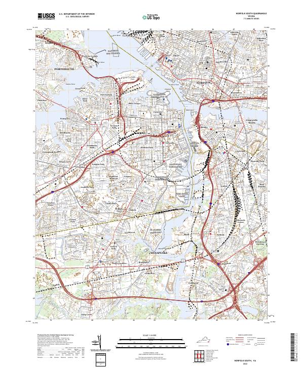
2022 Map of Norfolk South
USGS Topo · Published 2022About this map
The confluence of the Elizabeth River and its branches defines the complex urban and industrial landscape of Norfolk and Portsmouth in this 2022 survey. Extensive maritime infrastructure is evident along Town Point Reach and Washington Point, reflecting the region’s long-standing naval and commercial identity. The map captures a densely developed grid of historic neighborhoods such as Port Norfolk, Shea Terrace, and the planned community of Cradock, alongside significant institutional grounds including the Eastern Virginia Medical School.
Find a feature on this map
128 named features on this map. Tap any name to fly to it.
Don’t see what you’re looking for? This feature index may not catch every label — zoom into the map to look around manually.
Map Details
Editions of this 2022 Norfolk South Map
This is the sole edition of this map. No revisions or reprints were ever made.
Other maps of this area

1907 · Norfolk
USGS Topo · 1:125,000

1918 · Cape Henry
USGS Topo · 1:62,500

1919 · Cape Henry
USGS Topo · 1:62,500

1921 · Newport News
USGS Topo · 1:62,500

1939 · Moyock
USGS Topo · 1:62,500

1940 · Lake Drummond
USGS Topo · 1:62,500

1944 · Norfolk South
USGS Topo · 1:25,000

1945 · Lake Drummond
USGS Topo · 1:62,500

1946 · Moyock
USGS Topo · 1:62,500

1948 · Norfolk South
USGS Topo · 1:24,000