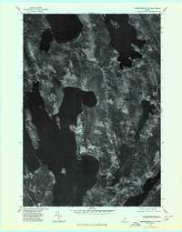
1975 Map of Norridgewock SE
USGS Topo · Published 1980About this map
North Belgrade anchors the southern portion of this mid-1970s orthophotograph, providing a clear visual record of the interconnected Belgrade Lakes region. Unlike traditional topographic maps, this imagery offers a direct view of the land as it appeared in October 1975, showing the relationship between shoreline development and the extensive agricultural and wooded tracts of Kennebec County. Small clusters of habitation are evident at Rome and Tyler Corner, while the vast surfaces of Great Pond and North Pond dominate the western and northern landscape. The map captures a moment before more modern expansion, detailing the precise footprint of the period's shorefront properties and the rural road network that connects East Pond to the northern reaches of Lake Messalonskee.
Find a feature on this map
7 named features on this map. Tap any name to fly to it.
Don’t see what you’re looking for? This feature index may not catch every label — zoom into the map to look around manually.
Map Details
Editions of this 1975 Norridgewock SE Map
This is the sole edition of this map. No revisions or reprints were ever made.
Other maps of this area

1892 · Waterville
USGS Topo · 1:62,500

1892 · Augusta
USGS Topo · 1:62,500

1893 · Vassalboro
USGS Topo · 1:62,500

1894 · Norridgewock
USGS Topo · 1:62,500

1898 · Norridgewock
USGS Topo · 1:62,500

1898 · Vassalboro
USGS Topo · 1:62,500

1941 · Vassalboro
USGS Topo · 1:62,500

1941 · Augusta
USGS Topo · 1:62,500

1943 · Augusta
USGS Topo · 1:62,500

1943 · Vassalboro
USGS Topo · 1:62,500