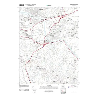
2010 Map of Norristown
USGS Topo · Published 2010About this map
The Schuylkill River defines the industrial and geographical spine of this region, separating Norristown and Bridgeport from the downstream hubs of Conshohocken and West Conshohocken. The river is heavily managed by infrastructure like the Philadelphia Electric Dam and Morristown Dam, which power the dense settlements along the banks. Prominent cemeteries including Montgomery Cemetery and Riverside Cemetery border the river, marking the long history of these riverside communities.
Find a feature on this map
229 named features on this map. Tap any name to fly to it.
Don’t see what you’re looking for? This feature index may not catch every label — zoom into the map to look around manually.
Map Details
Editions of this 2010 Norristown Map
This is the sole edition of this map. No revisions or reprints were ever made.
Other maps of this area

1891 · Philadelphia
USGS Topo · 1:62,500

1893 · Germantown
USGS Topo · 1:62,500

1894 · Chester
USGS Topo · 1:62,500

1894 · Philadelphia
USGS Topo · 1:62,500

1894 · Norristown
USGS Topo · 1:62,500

1894 · Germantown
USGS Topo · 1:62,500

1895 · Norristown
USGS Topo · 1:62,500

1896 · Germantown
USGS Topo · 1:62,500

1896 · Philadelphia
USGS Topo · 1:62,500

1896 · Norristown
USGS Topo · 1:62,500
Featured Places
- Philadelphia, PA
- Norristown, PA
- Radnor Township, PA
- King of Prussia, Upper Merion Township
- Whitemarsh Township, PA