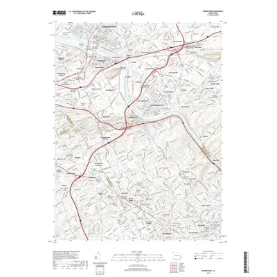
2019 Map of Norristown
USGS Topo · Published 2019About this map
The Schuylkill River carves a path through this dense suburban corridor, where historic industrial boroughs like Norristown, Bridgeport, and Conshohocken meet the storied Main Line academic landscape. The river is anchored by Barbadoes Island and flanked by intensive rail and road networks, including Septa lines and the Pennsylvania Turnpike. A remarkable concentration of historic burial sites and higher education institutions defines the area’s character, from the Montgomery County Courthouse to prestigious campuses such as Villanova University, Bryn Mawr College, and Haverford College. Genealogists will find a high density of religious and municipal landmarks, including the Old Swedes Christ Church Cem, the Plymouth Meeting Friends Cem, and the unique Francisvale Home for Smaller Animals Pet Cem. This modern survey reveals the evolution of historic crossroads like Plymouth Meeting and Lafayette Hill into contemporary centers of commerce and residence.
Find a feature on this map
168 named features on this map. Tap any name to fly to it.
Don’t see what you’re looking for? This feature index may not catch every label — zoom into the map to look around manually.
Map Details
Editions of this 2019 Norristown Map
This is the sole edition of this map. No revisions or reprints were ever made.
Other maps of this area

1891 · Philadelphia
USGS Topo · 1:62,500

1893 · Germantown
USGS Topo · 1:62,500

1894 · Chester
USGS Topo · 1:62,500

1894 · Philadelphia
USGS Topo · 1:62,500

1894 · Norristown
USGS Topo · 1:62,500

1894 · Germantown
USGS Topo · 1:62,500

1895 · Norristown
USGS Topo · 1:62,500

1896 · Germantown
USGS Topo · 1:62,500

1896 · Philadelphia
USGS Topo · 1:62,500

1896 · Norristown
USGS Topo · 1:62,500
Featured Places
- Philadelphia, PA
- Norristown, PA
- Radnor Township, PA
- King of Prussia, Upper Merion Township
- Whitemarsh Township, PA