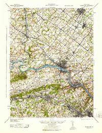
1943 Map of Norristown
USGS Topo · Published 1943About this map
Norristown stands as the primary industrial and rail hub of this mid-century landscape, positioned where the Reading railroad lines converge along the Schuylkill River. The map reveals a densely populated region of Montgomery County during the war years, characterized by a transition from the heavy industry of the river corridor to the residential and institutional pockets of the uplands. Notable landmarks like the Eastern State Penitentiary near Graters Ford and the regional post office at Lower Providence PO reflect the administrative and social infrastructure of the time. The drainage basins of Perkiomen Creek and Skippack Creek define the western reaches, where older settlements like Collegeville and Skippack are connected by established thoroughfares such as Ridge Road. This survey documents the area's intricate network of towns including Lansdale and North Wales, showing a mature suburban and industrial fabric before the era of major interstate expansion.
Find a feature on this map
146 named features on this map. Tap any name to fly to it.
Don’t see what you’re looking for? This feature index may not catch every label — zoom into the map to look around manually.
Map Details
Editions of this 1943 Norristown Map
This is the sole edition of this map. No revisions or reprints were ever made.
Other maps of this area

1888 · Quakertown
USGS Topo · 1:62,500

1890 · Doylestown
USGS Topo · 1:62,500

1890 · Quakertown
USGS Topo · 1:62,500

1891 · Doylestown
USGS Topo · 1:62,500

1891 · Philadelphia
USGS Topo · 1:62,500

1893 · Germantown
USGS Topo · 1:62,500

1894 · Quakertown
USGS Topo · 1:62,500

1894 · Chester
USGS Topo · 1:62,500

1894 · Philadelphia
USGS Topo · 1:62,500

1894 · Norristown
USGS Topo · 1:62,500
Featured Places
- Philadelphia, PA
- Norristown, PA
- Radnor Township, PA
- King of Prussia, Upper Merion Township
- Whitemarsh Township, PA