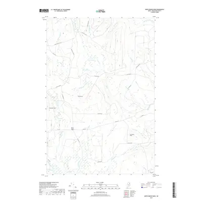
2018 Map of North Brook Ridge
USGS Topo · Published 2018About this map
North Brook Ridge stands as the central topographic feature in this wooded portion of Aroostook County, where a dense network of timber and logging routes defines the landscape. The northern reaches are drained by the N Br Meduxnekeag River and Hovey Brook, while prominent elevations like Long Brook Ridge and Carmichael Ridge overlook numerous small basins. Named roads such as Tie Camp Rd, Harvey Siding Rd, and 8 Mile Cut-Off Rd point to the area's history of forest management and early transit corridors. Water is a constant presence, with isolated pools like Little Fowler Pond and Scott Pond tucked between the ridges. The terrain rises to a local high point at The Pinnacle, providing a clear view of the hydrological divide between Carlisle Brook and Bear Brook.
Find a feature on this map
45 named features on this map. Tap any name to fly to it.
Don’t see what you’re looking for? This feature index may not catch every label — zoom into the map to look around manually.
Map Details
Editions of this 2018 North Brook Ridge Map
This is the sole edition of this map. No revisions or reprints were ever made.
Other maps of this area

1934 · Bridgewater
USGS Topo · 1:48,000

1935 · Howe Brook
USGS Topo · 1:48,000

1937 · Smyrna Mills
USGS Topo · 1:62,500

1938 · Bridgewater
USGS Topo · 1:62,500

1938 · Houlton
USGS Topo · 1:62,500

1939 · Howe Brook
USGS Topo · 1:62,500

1951 · Houlton
USGS Topo · 1:62,500

1951 · Bridgewater
USGS Topo · 1:62,500

1953 · Bridgewater
USGS Topo · 1:50,000

1954 · Howe Brook
USGS Topo · 1:62,500