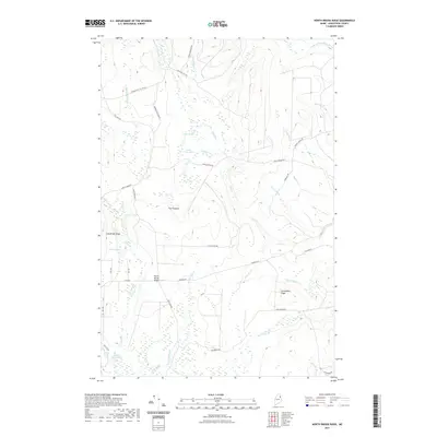
2021 Map of North Brook Ridge
USGS Topo · Published 2021About this map
North Brook Ridge stands at the center of this 2021 landscape in Aroostook County, defined by a complex network of timber and access roads such as 8 Mile Cut-Off Rd and Tie Camp Rd. The area is characterized by significant topographic features including Long Brook Ridge and Carmichael Ridge, which overlook numerous small water bodies like Little Fowler Pond and Carlisle Pond. The drainage pattern is dictated by several brooks, most notably the N Br Meduxnekeag River in the northeast and S Brook winding through the center. While formal settlements are sparse, the presence of Harvey Siding Rd hints at the region's historical connection to rail-side operations and forestry. This map provides a detailed view of the modern land management tracks and high-ground vantage points like The Pinnacle that define this interior Maine territory.
Find a feature on this map
46 named features on this map. Tap any name to fly to it.
Don’t see what you’re looking for? This feature index may not catch every label — zoom into the map to look around manually.
Map Details
Editions of this 2021 North Brook Ridge Map
This is the sole edition of this map. No revisions or reprints were ever made.
Other maps of this area

1934 · Bridgewater
USGS Topo · 1:48,000

1935 · Howe Brook
USGS Topo · 1:48,000

1937 · Smyrna Mills
USGS Topo · 1:62,500

1938 · Bridgewater
USGS Topo · 1:62,500

1938 · Houlton
USGS Topo · 1:62,500

1939 · Howe Brook
USGS Topo · 1:62,500

1951 · Houlton
USGS Topo · 1:62,500

1951 · Bridgewater
USGS Topo · 1:62,500

1953 · Bridgewater
USGS Topo · 1:50,000

1954 · Howe Brook
USGS Topo · 1:62,500