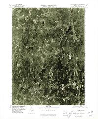
1975 Map of North Brookfield
USGS Topo · Published 1981About this map
North Brookfield and the surrounding Worcester County landscape are captured here through mid-1970s aerial photography, revealing a pattern of agricultural clearings and dense woodlands typical of central Massachusetts. This orthophotoquad provides a unique visual record of the region before significant modern development, showing the spatial relationship between the primary settlement at North Brookfield and the smaller cluster at Hillsville. The drainage of the area is clearly visible, dominated by the Ware River in the northwest and the winding paths of the Five Mile River and Seven Mile River. To the north, the town of Oakham sits within a rugged terrain marked by prominent landmarks like Tufts Hill and water bodies such as Brooks Pond. This specific format allows researchers to see the exact footprint of farms and wooded lots as they existed in 1975, rather than just stylized topographic symbols.
Find a feature on this map
9 named features on this map. Tap any name to fly to it.
Don’t see what you’re looking for? This feature index may not catch every label — zoom into the map to look around manually.
Map Details
Editions of this 1975 North Brookfield Map
This is the sole edition of this map. No revisions or reprints were ever made.
Other maps of this area

1885 · Worcester
USGS Topo · 1:62,500

1886 · Worcester
USGS Topo · 1:62,500

1887 · Brookfield
USGS Topo · 1:62,500

1887 · Barre
USGS Topo · 1:62,500

1889 · Webster
USGS Topo · 1:62,500

1889 · Barre
USGS Topo · 1:62,500

1890 · Brookfield
USGS Topo · 1:62,500

1892 · Webster
USGS Topo · 1:62,500

1892 · Worcester
USGS Topo · 1:62,500

1893 · Brookfield
USGS Topo · 1:62,500