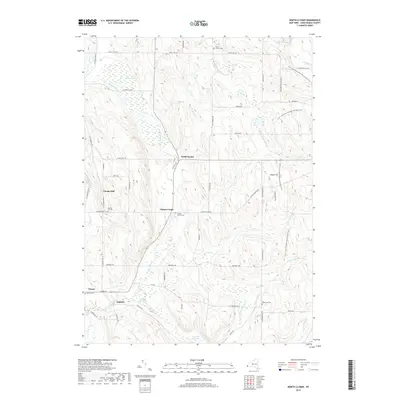
2019 Map of North Clymer
USGS Topo · Published 2019About this map
North Clymer and its surrounding hamlets define this rural Chautauqua County landscape, where the headwaters of French Cr and Brokenstraw Cr carve through a network of dairy country roads. The map reveals a high concentration of burial grounds serving these early communities, including Wait's Corners Cem and the Clymer Center Cem, reflecting the deep-rooted family lineage of the area. Significant wetlands like Perkins Swamp and Tamarack Swamp occupy the lower basins between ridges, while the Fred J. Cusimano Westside Overland Trail winds across the eastern heights of Sweet Hill. This survey captures the traditional agricultural layout of the region, from the cluster at Jaquins to the high-elevation settlement of Clymer Hill, preserving the names of the family-named roads and drainage systems that have shaped local life for generations.
Find a feature on this map
57 named features on this map. Tap any name to fly to it.
Don’t see what you’re looking for? This feature index may not catch every label — zoom into the map to look around manually.
Map Details
Editions of this 2019 North Clymer Map
This is the sole edition of this map. No revisions or reprints were ever made.
Other maps of this area

1904 · Chautaqua
USGS Topo · 1:62,500

1905 · Clymer
USGS Topo · 1:62,500

1926 · Youngsville
USGS Topo · 1:62,500

1929 · Corry
USGS Topo · 1:48,000

1929 · Youngsville
USGS Topo · 1:62,500

1932 · Corry
USGS Topo · 1:62,500

1939 · Clymer
USGS Topo · 1:62,500

1941 · Chautauqua
USGS Topo · 1:62,500

1941 · Clymer
USGS Topo · 1:62,500

1943 · Youngsville
USGS Topo · 1:62,500